Loading Events

« All Events

  • This event has passed.

A Moment in Time and Space – GPS

05/10/2011 @ 7:30 pm - 11:00 pm

By Einstein, it is all relative! So, with a universe of no absolutes, how do we know what time it is for “when” we are let alone where we might be whenever?…

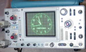
GPS to AVR to CRT!

GPS to AVR to CRT!

With a doctorate or three, some beer, a little hand-waving, and some good down-to-Earth detail and examples, we might find out where we are and learn something of the ethereal trickery for how a few clocks in space transmitting a radio time signal can form a Global Positioning System to tell us (relatively) where we are:

A Moment in Time and Space – A Rough Guide to GPS
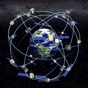
A Constellation of GPS

A Constellation of GPS

DON’T BLINK! Not even for a moment, as Dr Dr Dave Luff untangles space and time for one small area…

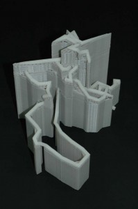
GPS path log to 3D printout

GPS path log to 3D printout


All at our usual local coordinates:

Fellows Morton and Clayton
54 Canal Street
Nottingham, NG1 7EH
Telephone: 0115 9506795

To find us,  go through to the back of the pub and we’re up the spiral staircase in the restaurant. Just ask one of the friendly bar staff for NLUG if lost.

Food is also served through into the evening.


Wednesday 05/10/2011:

  • 7:30pm: Meet
  • 8:00pm: Talk
  • 9:00pm: General discussions

Cuddly Gnus, Penguins, and All welcome!


Cheers,
Martin


GPS: Global Positioning System
AVR: Alf (Egil Bogen) and Vegard (Wollan)’s Risc processor, a microcontroller adopted by Atmel
CRT: Cathode Ray Tube

Details

Date:
05/10/2011
Time:
7:30 pm - 11:00 pm
Event Category:

Venue

Fellows Morton and Clayton
54 Canal Street
Nottingham, NG1 7EH United Kingdom
+ Google Map
Phone:
0115 9506795

22 comments to A Moment in Time and Space – GPS

  • martin

    The Register 28/11/2011: Russia successfully launches Glonass-M

    (And after the Phobos-Grunt recent disappointment) Sweaty Russian space bosses heave sigh of relief

    … GLONASS, an acronym for Globalnaya navigatsionnaya sputnikovaya sistema or Global Navigation Satellite System, is Russia’s version of GPS and today’s satellite will join 30 others already in orbit to help Russians navigate…

  • Martin L

    Two not-so-obvious problems with GPS to watch out for…

    study reveals GPS jammer use

    … One sensor placed in a city next to some docks and a two-lane link motorway found 67 incidents of vehicles using GPS jamming over a six-month period…

    … People illegally jam GPS for a number of reasons… These include evasion of company-vehicle or covert tracking, and stealing high-value vehicles. …

    … GPS jamming and spoofing can have serious effects on geolocation and communications technologies that rely on GPS for positioning and timing; maritime and aircraft GPS use, and even stock market trading…

    And:

    OPERA grabs spanner, fixes kit, and slows down neutrinos

    “Ye canna break the laws of physics, it seems” … “a bad connection between a GPS unit and a computer may be to blame” … The experiment last year seemed to identify neutrinos completing their trip between CERN at Geneva and Gran Sasso 60 nanoseconds too quickly. … After tightening the connection … OPERA researchers have found that the GPS data arrived 60 nanoseconds earlier than was measured during the original experiment. …

    And then also sadly, an example just waiting to happen:

    Boy died after satnav fault delays ambulance

    There are also examples of blind reliance going wrong:

    Satnav blunders blamed for £200m damages

  • Martin L

    Another ‘SatNav glitch’:

    TomTom sat-nav devices hit by GPS ‘leap year bug’

    TomTom has blamed a “leap year bug” for a fault causing some of its satellite navigation devices to malfunction.

    The firm said that a problem with its global positioning system firmware – code embedded into the devices – was causing “a limited number of models” to fail to identify their location.

    Affected users are presented with a grey screen and a message saying the machine lacks a GPS signal.

    The firm said that it was working on a fix and promised further updates.

    The Dutch company said that the issue first emerged on 31 March. …

  • Martin L

    Here’s an interesting parallel system to GPS:

    BAE Systems’ Navsop navigation system rivals GPS

    A new positioning system has been developed to complement or even replace current technologies such as GPS.

    Made by UK defence firm BAE Systems, it relies on the same signals used by mobile phones, TVs, radios and wi-fi rather than navigation satellites. …

    I wonder how well that works without dedicated broadcast transmitters? Or are transmissions from mobile phone masts and TV transmitters stable enough to be ‘good enough’? And for how long term? Interesting…

  • Martin L

    An example of another leap… Of one second recently:

    Leap second and storm disrupt weekend web services

    Several high-profile websites and services suffered over the weekend thanks to the leap second and huge storms.

    An extra second added to the world clock saw the likes of Reddit and Foursquare fall over. …

    … On 30 June, at 23:59:60 (00:59:60 BST), the extra second was added to Coordinated Universal Time (UTC).

    The slight change meant several high-profile sites which rely heavily on synchronised operations were disrupted.

    Computing expert Prof Alan Woodward, from the University of Surrey, explained that the leap second can knock services out-of-sync and lead to missing data.

    “Across the global internet, a lot can happen in that second,” he said. …

    Surprising how much software simply assumes that leap days and leap seconds do not exist and yet simply use ‘local’ time for their critical functions! Note the admonishment in Vixie crond:

    Daylight Saving Time and other time changes

    Local time changes of less than three hours, such as those caused by the start or end of Daylight Saving Time, are handled specially. This only applies to jobs that run at a specific time and jobs that are run with a granularity greater than one hour. Jobs that run more frequently are scheduled normally.

    If time has moved forward, those jobs that would have run in the interval that has been skipped will be run immediately. Conversely, if time has moved backward, care is taken to avoid running jobs twice. …

  • Martin L

    Another small launch to orbit, one giant leap for Galileo:

    Galileo: Europe’s version of GPS reaches key phase

    The third and fourth spacecraft in Europe’s satellite navigation system have gone into orbit. The pair were launched on a Russian Soyuz rocket from French Guiana. It is an important milestone for the multi-billion-euro project to create a European version of the US Global Positioning System (GPS).

    With four satellites now in orbit – the first and second spacecraft were launched in 2011 – it becomes possible to test Galileo end-to-end. That is because a minimum of four satellites are required in the sky for a smartphone or vehicle to use their signals to calculate a positional fix.

    … “Of course, these four satellites will be visible [only] during intermediate periods of time,” … “But from now on, receiver manufacturers will be able to start testing the system and preparing for Galileo services.” …

    … It will be some time before general sat-nav users are able to see the benefits of Galileo, however. This will have to wait until a public navigation signal is switched on, and it is likely to be 2015 before there are enough spacecraft in orbit for the system to start to show its true capability.

    Full deployment (27 operational satellites and three spares) is likely to take most of the decade.

    Compared with the US’s current version of GPS, Galileo promises more accurate and more precise fixes, although the Americans themselves are planning to upgrade their infrastructure in the coming decade. …

  • Martin L

    Here’s a rag-bag of recent GNSS bits and pieces, as some wish to join the party whilst others try to spoil the fun, and everyone wants to boldly party where noone has done so before:


    India to have its own GPS soon

    The first of the seven satellites, Indian Regional Navigation Satellite System (IRNSS), will be launched during the second week of June 2013 giving India its own indigenous air navigation system/Global Positioning System (GPS), which would provide information on location and time in all weather conditions. …


    The Register: Seoul plans anti-GPS jamming system to thwart NORKS

    South Korea is finalising plans to track down and block GPS jamming signals emitted by its increasingly belligerent northern neighbour.

    Unnamed official government sources told Yonyap news agency that the GPS surveillance system…

    … There are no details as yet as to which technology South Korea may turn to in tracking and defending against GPS-jamming, although solutions certainly exist. …


    ITT Exelis to provide anti-jam GPS antennas for KC-46 refueling aircraft

    … The rugged N79 Controlled Reception Pattern Antenna, or CRPA, prevents deliberate jamming and unintentional interference of timing signals … The antenna keeps an aircraft’s GPS system connected in the presence of multiple threats. …


    Galileo Satellite Achieves High Earth Orbit Positioning with GPS

    … GIOVE-A has been able to fix its position, velocity, and time from GPS signals, despite orbiting more than 1,000 kilometers (620 miles) above the orbits of the downward-pointing U.S. satellites.

    The results demonstrate that current GNSS signals could guide missions much further away in space, up to geostationary orbit or even as far as the Moon, researchers say…


    The Inner Edge: Who Holds the Key to Indoor Nav?

    The FCC released in March results of intensive indoor location trials of various technology solutions to this most difficult of PNT problems … The results will shape FCC-mandated position-reporting requirements for cell phones, and will drive future development of all indoor positioning applications. …

    … The massive R&D movement focus on consumer-level applications, that is, cell phones, but this work will also ultimately affect professional and high-precision uses of GNSS. Those involved in machine control for warehousing, industrial assembly, indoor and even underground mapping, construction both above- and underground, underground mining, utility work, and even forestry will find this of particular interest — any activity in areas where sky-view is limited or negligible.

    Today, well more than half of mobile phone calls are made inside buildings. The number of emergency calls roughly parallels that, and both figures are only projected to rise. The FCC has a clear mandate to bring E-911 capability to indoor calls.

    The 2001 regulations governing such emergency calls required that both landlines and cellphones should provide the location of callers to within specific accuracy levels. …


    DARPA makes an indoor GPS chip that’s smaller than a penny

    … The device is designed to start working as soon as you lose your regular GPS signal. From that starting point, the gyroscopes and accelerometers keep track of how far away you are–as well in which direction you have moved–from that initial point.

    DARPA is developing the technology to help keep track of troops fighting in urban and indoor situations where satellite tracking may not work. Since the device is so small, we imagine that the TIMU could eventually end up inside our mobile devices because it’s pretty easy to get lost indoors, too. I mean, have you ever been to a MegaMall?

  • Martin L

    So what’s with a second or so in 3.15 x 10^10 seconds (or 1000 years in less mind-numbing numbers)?

    The Register: Brit horologist hammers out ‘first’ ATOMIC-POWERED watch

    Could this be the chronometrist’s ultimate timepiece, the peak of horological haute couture? British bespoke movement maker Hoptroff today claimed to have produced the world’s first personal chronometer with an on board atomic clock. …

    … Unfortunately, the SA.45s is small but not tiny. At 40 x 34.8 x 11.3mm, it’s too big to go into a wristwatch, so Hoptroff’s mechanism has been designed for pocket watches. Full- or half-hunter – or even open case – is presumably up to you. …

    The shape of times to come?… 😉

  • Martin L

    For some extreme homebrew single bit twiddling of the sort our group experienced scribbled on the chart during Dave’s talk, see this RasPi enhanced version:

    Homemade GPS receiver

    Andrew Holme is a member of the Systems Group at Broadcom Cambridge. He’s friends with several of Raspberry Pi’s engineers, and he’s been working on a homemade GPS receiver in the evenings for the last few years. Recently, he’s added a RasPi to create a truly portable, battery-powered receiver.

    It’s a remarkable piece of work. It shouldn’t be possible to build a GPS receiver like this…

    Indeed some remarkably dedicated homebrew bit twiddling! Fantastic 🙂

  • Martin L

    For that elusive one second in 300 million years:

    Optical lattice atomic clock could ‘redefine the second’

    … We once used the Earth’s rotation to measure time, where one spin equates to a day.

    But because our planet wobbles on its axis as it rotates, some days can be shorter or longer than others.

    The atomic clock has proved to be a far more accurate method of keeping the world on time and since the 1960s has been used to define a second in the International System of Units (SI units).

    But now scientists say the optical lattice clock could improve the precision…

    … Another clock is also undergoing development – an ion clock. This clock loses just one second every few billion years, but because it relies on a single ion, it is not yet deemed to be stable enough for widespread use.

    One comment to that article gives a very good reminder of how time and space are unavoidably connected: “even with this method, we are not really measuring time itself. By detecting atomic vibrations we are measuring distances, not time.”

    Indeed, what is time when our own existence is a part of that very same time?

  • Martin L

    You may on occasion be mislead by out of date data for your ‘satnav’. There is now also this demonstration of critical civilian GPS systems being lead astray:

    Texas students hijack superyacht with GPS-spoofing luggage

    Students from the University of Texas successfully piloted an $80m superyacht sailing 30 miles offshore in the Mediterranean Sea by overriding the ship’s GPS signals without any alarms being raised…

    … In the case of the White Rose of Drachs hijacking, there’s also little need for concern. The ship carries a crew of 18 and no captain relies solely on GPS…

    Really, noone blindly relies upon their GPS?…

  • Martin L

    On a slightly grander scale:

    Pulsars: the GPS beacons of the cosmos

    Want to navigate over huge distances with nearly superhuman accuracy? All you need is a laptop, the right software, and some way to keep track of the signals of distant pulsars…

    … created by Hobbs in collaboration with RT Edwards and RN Manchester, it takes work begun in the 1970s (the original TEMPO) and updated it for the gravity-wave hunt – and incidentally created a reference point suitable for solar system navigation.

    In measuring pulsars, Dr Hobbs explained, “we need to know the centre of mass of the solar system to within a metre or so … and we updated TEMPO2 to allow you to fit for an error in the position between your telescope and the centre of mass of the solar system.”

    … [And] with such an accurate way to measure the centre of mass of the solar system, the same technique could be applied to spacecraft… “you could identify where you are, anywhere in the Galaxy”…

    After all, to find where you are in time and space, it’s only a question of relative time…

  • Martin L

    One to watch out for here on Earth from up above!

    Apple Maps flaw results in drivers crossing airport runway

    An Alaskan airport has closed an aircraft access route because of a flaw with Apple’s Maps app…

    …in the past three weeks two motorists had driven along the taxiway and across one of its runways. Apple’s app directs users along the taxiway…

    …”We asked them to disable the map for Fairbanks until they could correct it, thinking it would be better to have nothing show up than to take the chance that one more person would do this,”… She added that barricades had since been erected to block access to the final stretch of the taxiway and that they would not be removed until Apple had updated its directions. …

    … Fairbanks Airport said the drivers involved in the 6 September and 20 September incidents had both been from out of town and had ignored signposts warning them that they should not be driving along the taxiway. “No matter what the signs say, the map on their iPhone told them to proceed…

  • Martin L

    India expands its ‘local’ GNSS:

    India’s GPS alternative launches second satellite

    Closed satnav system due to have all seven birds aloft by 2016

    India has launched its second navigation satellite, the daintily-named IRNSS-1B.

    IRNSS is an acronym for “Indian Regional Navigation Satellite System” and the name is noteworthy because the planned seven-satellite constellation is intended to provide location services within India and in an “extended service area” around the nation, rather than offering the global coverage other satnav systems promise (alone or in collaboration).

    The local focus is because India wants IRNSS all to itself. That position is understandable: the USA’s GPS, Russia’s GLONASS, Europe’s Galileo and China’s Beidou are all controlled by states that could conceivably jam the systems’ signals. With India perennially wary of its neighbours (and owning nuclear weapons), possessing its own satellite navigation constellation has obvious strategic importance…

  • Martin L

    And yet another example of when the use of GNSS “goes wrong”…

    Map illustrates ‘Russian GPS’ failure

    … Satellites of the GLONASS network experienced a half-day outage when bad data was uploaded to spacecraft.

    The GLA map shows a GLONASS receiver at Harwich giving corrupted position fixes that were off by more than 50km.

    The Authorities say the 2 April event is a timely reminder that alternatives to satellite navigation are essential. The GLA themselves are supporting a system in the UK and Ireland called eLoran, which transmits long-range position, navigation and timing signals from a ground-based radio network.

    Its primary use is for ships and others in the maritime sector, but there is a feeling also that eLoran could provide a robust back-up for GPS, GLONASS, and Galileo when it arrives…

  • Martin L

    Japan plans SEVEN satellite launches to supercharge GPS

    Quasi-Zenith Satellite System aims accuracy to within centimetres

    Japan is set to fire seven satellites into orbit over the coming years as part of plans to enhance GPS so locations can be pin-pointed to within centimetres rather than metres…

    … Rather than replace the US system wholesale, the aim is apparently to correct any inaccuracies in GPS tracking so that locations in Japan can be calculated down to within centimetres.

    “GPS positioning can be off by as much as 10 meters due to various kinds of errors,” Mitsubishi research engineer, Yuki Sato, told IEEE Spectrum. “And in Japan, with all its mountains and skyscrapers blocking out GPS signals, positioning is not possible in some city and country locations.”…

    … QZS-1 has apparently already begun trials and found the accuracy to be around 1.3 centimetres horizontally and 2.9 cm vertically. When fully operational, QZSS is expected to enhance sat-nav and the extra accuracy achieved could also be used by unmanned vehicles.

    The Japanese government is apparently also planning to use the satellites to broadcast short bursts of information during natural disasters, when ground-based comms may be damaged.

  • Martin L

    Meanwhile… Anyone lost for a bit of a spoof?…

    Study maps ‘extensive Russian GPS spoofing’

    … It involves the state using strong radio signals to drown out reliable navigation data, says non-profit C4ADS. The report by the think tank documents almost 10,000 separate GPS spoofing incidents conducted by Russia.

    Most incidents affected ships, said C4ADS, but spoofing was also seen around airports and other locations…


    A little something not to be relied upon, and yet all too many people WILL rely upon GNSS simply because it appears to be reliable. Until it is not.

    Good comment as always can be found on the corresponding The Register article: How do you sing ‘We’re jamming and we hope you like jamming, too’ in Russian? Kremlin’s sat-nav spoofing revealed

    Dangerous stuff… Anyone for thousands of tonnes of ship or an airliner landing in your living room ‘by mistake’?…


    GNSS: Global Navigation Satellite System

  • Martin L

    Now this ain’t supposed to happen! Timelessly losing your position?!!…

    In great The Register reporting:

    Galileo, Galileo, Galileo, where to go? Navigation satellite signals flip from degraded to full TITSUP* over span of four days

    *Timing Is Terrible Say Users Plaintively

    The multibillion-euro navigation system Galileo went dark over the weekend.

    Things began to wobble last Thursday, 11 July, as the European Global Navigation Satellite Systems Agency (EGSA) issued an advisory at 14:45 UTC warning of “service degradation”. At the time, sat-nav mag Inside GNSS reported that sources within the agency reckoned things would be back to normal over the weekend.

    Unless normal service equals “borked beyond belief”, things went downhill rapidly as a subsequent advisory issued on Saturday upped the designation to “service outage”…

    … The problem appears to be related to a facility on the ground that generates the time used by the satellites to provide position information…


    That is quite an outage! Also, not the best of birthdays for the system 🙁

    At least my multiple sources for ntpd have kept ticking along… 😉

    Beware common mode or common source faults 🙁

  • Martin L

    Meanwhile…

    China marches along to complete the latest upgrade to BeiDou and to bring in its neighbors ever closer:


    China launches final satellite in challenge to GPS

    China has successfully put into orbit the final satellite in its BeiDou-3 navigation system, further advancing the country as a major power in space.

    Tuesday’s launch will allow China to no longer rely on the US government-owned Global Positioning System (GPS)…

    … The third version of the Beidou Navigation Satellite System (BDS) offers an alternative to Russia’s GLONASS and the European Galileo systems, as well as America’s GPS. Future plans promise to support a more accessible and integrated system scheduled to come online by 2035 with BDS at its core…


    China praises Pakistan SatNav collaboration

    … Beidou is another example of China building infrastructure it uses to strengthen alliances around the world. The SatNav constellation covers all of China and stretches north to Japan, west to Iran, south to Australia and east to reach most of the Pacific Ocean.

    That’s rather smaller than either the US-centric GPS network or Europe’s Galileo, but China doesn’t need global coverage to satisfy consumers, industrial users or its military. The latter users are important because it’s widely held that in an armed conflict GPS would be made unavailable to an adversary. Russia and India have built SatNav networks for similar reasons.

    Pakistan signed up as a Beidou user several years ago, a coup for China because it was able to build ground stations there…


    Does that all add up to making the world a smaller place?

    To misquote a fabled supposed Chinese saying: May we live in prosperous times!

Leave a Reply